HemiStereo Technology
Stereo Vision
Stereo vision based 3D scanning technology is one of the most measure and prominent spacial measurement method: Commonly, two cameras, or in rare cases three cameras with pespective projecting characteristic are combinded and their (2D) images are correlated in order to recover depth (3D) information. One of the major limitation is the restricted field of view which is normally limited to ~90° or ~120° respectively. HemiStereo sensor technology fundamentally overcomes this problem and realizes real-time image based 3d measurement by means of high-resolution cameras with fish-eye projecting capability.
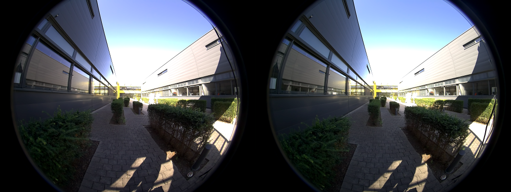
Fig. 1.1: Image Pair with Fisheye Projection
Hemispherical Distance Measurement
HemiStereo Software-Core is able to process full fisheye image pairs for generating dense distance maps in real-time. The result is shown in Fig. 1.2 and represents an almost full hemispherical 3d information of the sensors vicinity by means of equiangular projection.
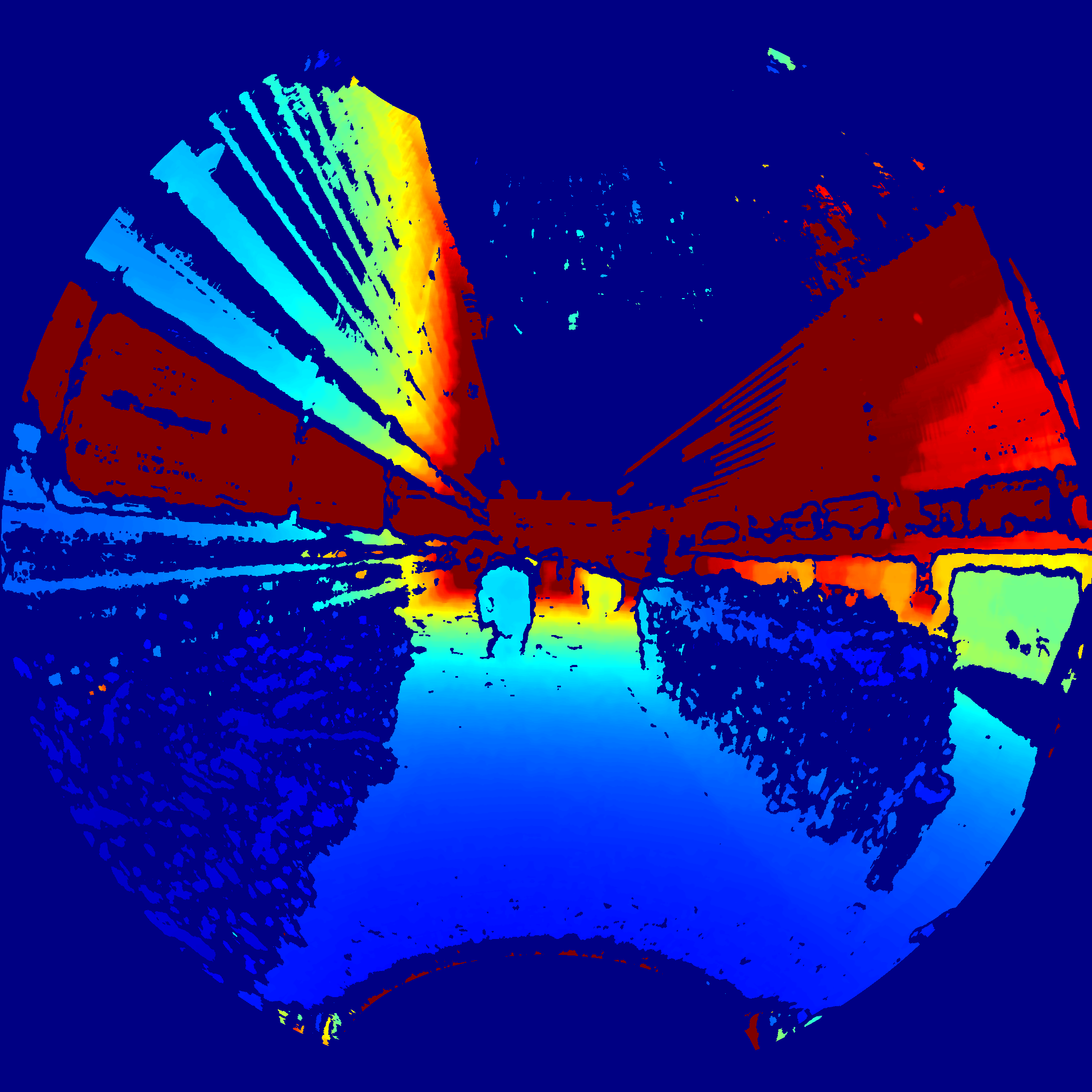
Fig. 1.2: Color Coded Dense Distance Map (Equiangular Projection)
Flexible Projection
The HemiStereo software core is highly flexible to the users needs and may calculate the 3d information by means of a variety of projection models.
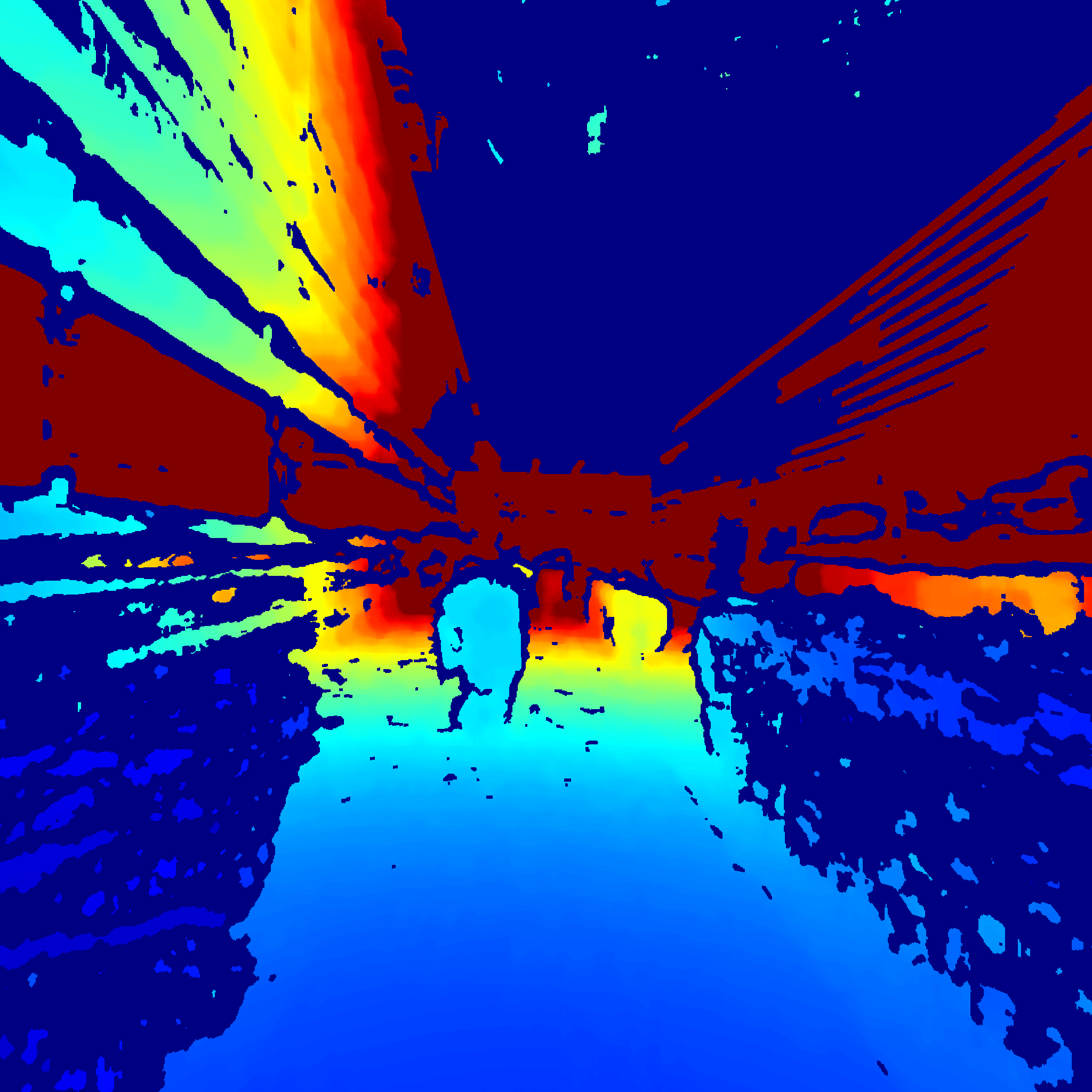
Fig. 1.3 Color Coded Dense Distance Map (Perspective Projection)
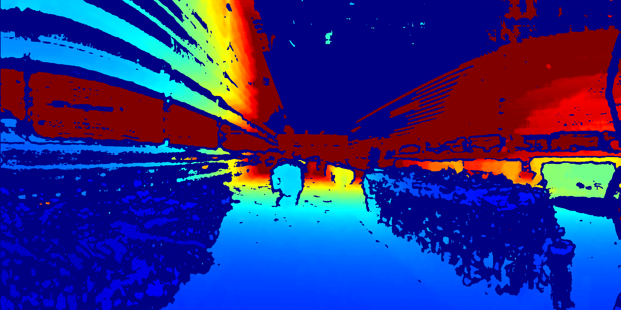
Fig. 1.4: Color Coded Dense Distance Map (Equirectangular Projection)
Point Cloud
What ever you choose, you will get a high detailed point cloud in metric coordinates.

Fig. 1.5: Point Cloud